
Garmin Navionics Platinum+ Aegean Sea Chart | NPEU015R
September 4, 2026
C-MAP DISCOVER Aegean Sea Chart | Lowrance & Simrad
September 4, 2026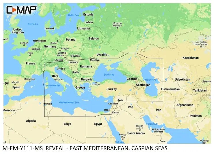
Original price was: 248.00€.240.00€Current price is: 240.00€.
C-MAP® REVEAL™ – East Mediterranean, Black & Caspian Seas
Stock: available
C-MAP® REVEAL™ – East Mediterranean, Black & Caspian Seas
Overview
The C-MAP® REVEAL™ – East Mediterranean, Black & Caspian Seas marine chart provides premium cartography for compatible Lowrance®, Simrad® and B&G® chartplotters. Covering the Eastern Mediterranean, Black Sea and Caspian Sea regions, it combines detailed navigation data with advanced visual layers to support safer cruising, sailing and fishing.
Building on all the features of C-MAP® DISCOVER™, the REVEAL™ edition adds Shaded Relief, Satellite Imagery, Aerial Photography, and Reveal Seafloor Imagery for an enhanced understanding of underwater terrain and coastal environments. The chart also includes 12 months of online updates to keep navigation data current.
Main Features
- Coverage of the East Mediterranean, Black & Caspian Seas
- Premium C-MAP® REVEAL™ cartography
- High-Resolution Bathymetry
- Reveal Seafloor Imagery
- Shaded Relief (3D seabed visualization)
- Satellite Overlay
- Aerial Photography of marinas and ports
- Easy Routing™
- Custom Depth Shading
- Integrated Genesis® bathymetry
- Tides & Currents
- 12 months of online chart updates
Specifications
| Specification | Value |
|---|---|
| Brand | C-MAP |
| Product Series | REVEAL™ |
| Part Number | M-EM-Y111-MS |
| Product Type | Marine Chart |
| Coverage Area | East Mediterranean, Black & Caspian Seas |
| Media Type | microSD™ card with SD adapter |
| Chart Format | Preloaded |
| Compatibility | Compatible Lowrance®, Simrad® and B&G® chartplotters (Legacy C-MAP / MAX-N+) |
| High-Resolution Bathymetry | Yes |
| Reveal Seafloor Imagery | Yes |
| Shaded Relief | Yes |
| Satellite Overlay | Yes |
| Aerial Photography | Yes |
| Dynamic Raster Charts | Yes |
| Easy Routing™ | Yes |
| Custom Depth Shading | Yes |
| Tides & Currents | Yes |
| Genesis® Layer | Integrated |
| Online Updates | 12 months included |
Package Contents
- C-MAP® REVEAL™ East Mediterranean, Black & Caspian Seas chart card
- microSD™ to SD™ adapter
- Documentation